Open storage land opportunity with freshly laid hardcore concrete and excellent road links
Summary
- Leasehold
- Site extends to circa 6.53 acres
- Pricing: £6psf
- Offered with vacant possession
- Available as a whole or can be split into smaller parcels of land (subject to availability)
Location
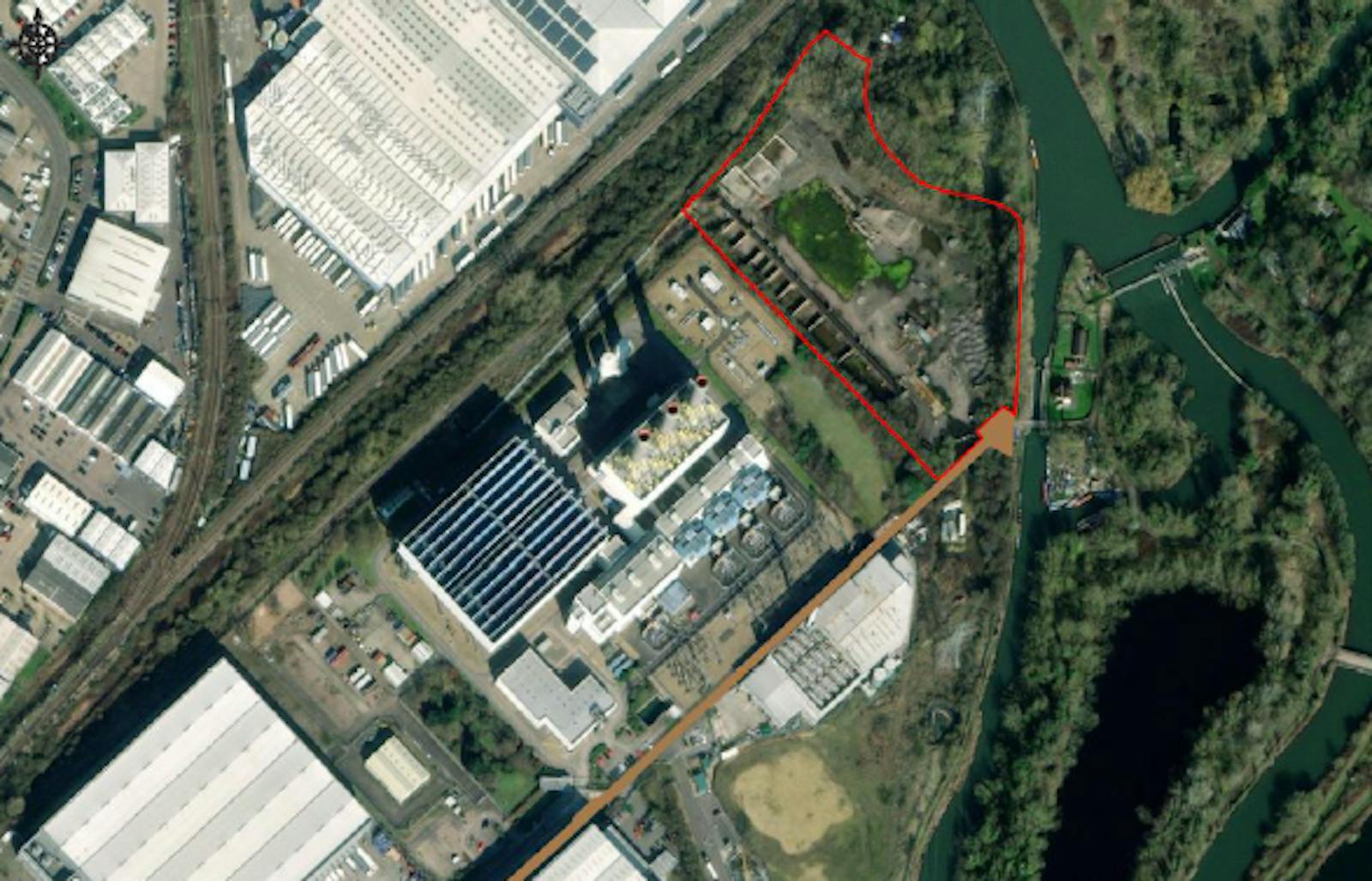
The site lies at the north-eastern end of Ratty’s Lane, which is situated immediately adjacent to Rye House Power Station. The River Lee Navigation runs along the eastern boundary. The site is accessed from the A1170 which in turn links up to the A10 which provides direct access to the M25, A1 and M11 as well as other major road links.
Get directions from Google Maps
Mainline Stations
-
Rye House10 mins
-
Roydon26 mins
-
Broxbourne29 mins
-
St Margarets (Herts)34 mins
Underground Station
-
Broxbourne28 mins
-
Cheshunt85 mins
-
Theobalds Grove102 mins
-
Waltham Cross108 mins
Further Information
Rent £260,000 per acre
Rates Payable Upon Enquiry
Description
The property comprises a parcel of land that was historically used as for storage of aggregates and totals approximately 6.53 acres (2.642 hectares) in size. The plot forms a broadly rectangular shape, with the entire site benefitting from concrete hardstanding and all boundaries are secured by way of palisade fencing and bund. In terms of services to the site, electricity is present on site with other utilities and water to be installed if required.
Situation
The site is located within an established employment location with a range of storage & distribution, trade and other commercial occupiers. It is home to several notable businesses such as J Sainsbury’s, Culina Group, Best Food Logistics, Great Bear Distribution, Iron Mountain and Biogen to name just a few. The land is positioned in between the Rye House Power Station and Hoddesdon Advanced Thermal Treating Plant with the commercial uses shifting towards storage & distribution with a mix of trade occupiers approaching the A1170 before Hoddesdon town centre which is largely residential in nature.
Planning
The site falls within the Local Authority of Broxbourne Borough Council, which is located in the wider jurisdiction of Hertfordshire. The site benefits from consent for open-storage and is located within an existing Employment Area (ED2).
Downloads
Gallery