Outstanding development land opportunity in highly sought-after Ponteland, Northumberland.
Summary
- Outstanding development land opportunity in highly sought-after location.
- Site area of approximately 5-acres.
- Positive Pre-Application Enquiry response received supporting the principle of a range of uses, including residential.
- Informal sealed tenders sought by 12noon Wednesday 9th September 2026.
Location
The town of Ponteland is located within the administrative area of Northumberland County Council. It has a population of 11,669 (2021 Census).
Ponteland is positioned approximately 8-miles north-west of Newcastle upon Tyne. Darras Hall is located to the south of Ponteland and is recognised as one of the regions prime executive housing locations with a large number of homes having multi million-pound values.
The town is a well-served, affluent and benefits from a range of facilities and amenities including schools, local and regional retail/shops (including Waitrose), pubs, restaurants, care homes, a golf club and leisure and recreational facilities.
Get directions from Google Maps
Further Information
Price Price on application
Description
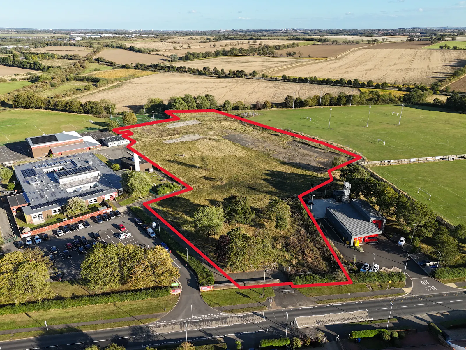
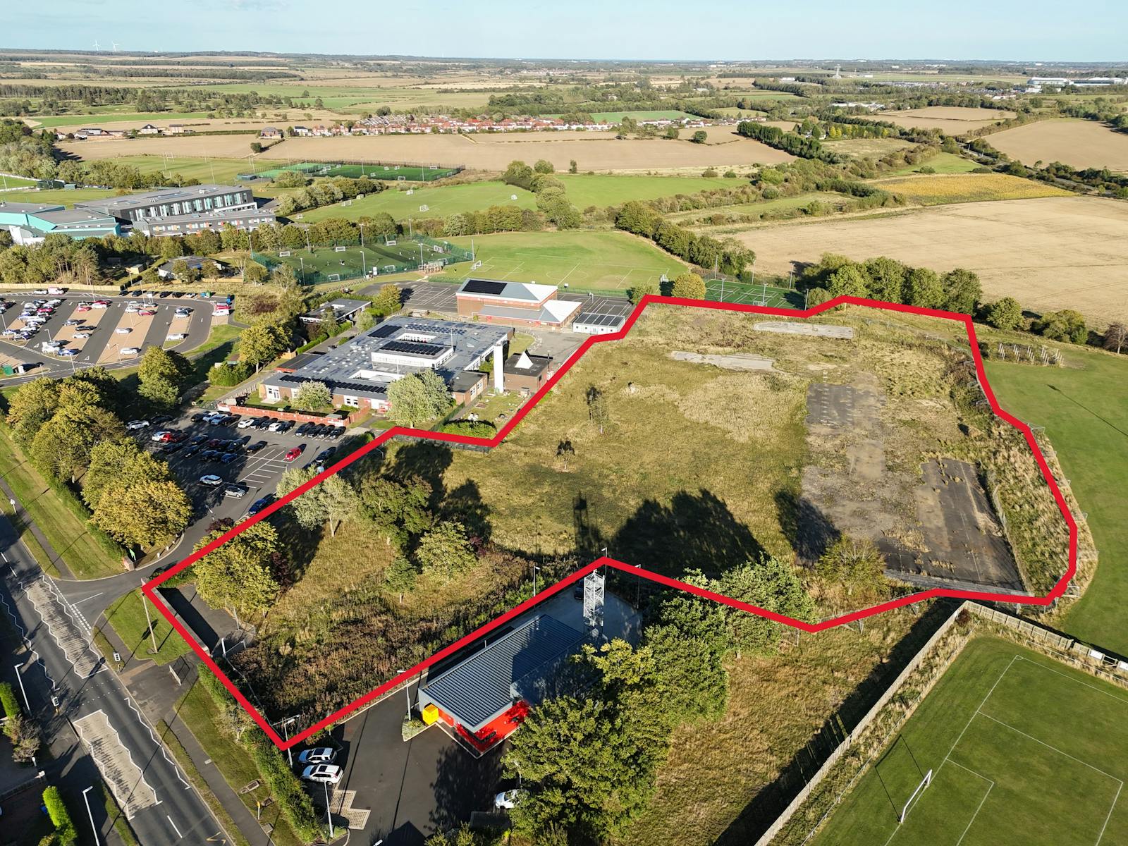
The site extends to approximately 5-acres (2-hectares) gross area. It is irregular in shape, is mainly flat and is shown edged red on the site plan included within these particulars. Footpath (reference: 419/016) is positioned to the east of the site.
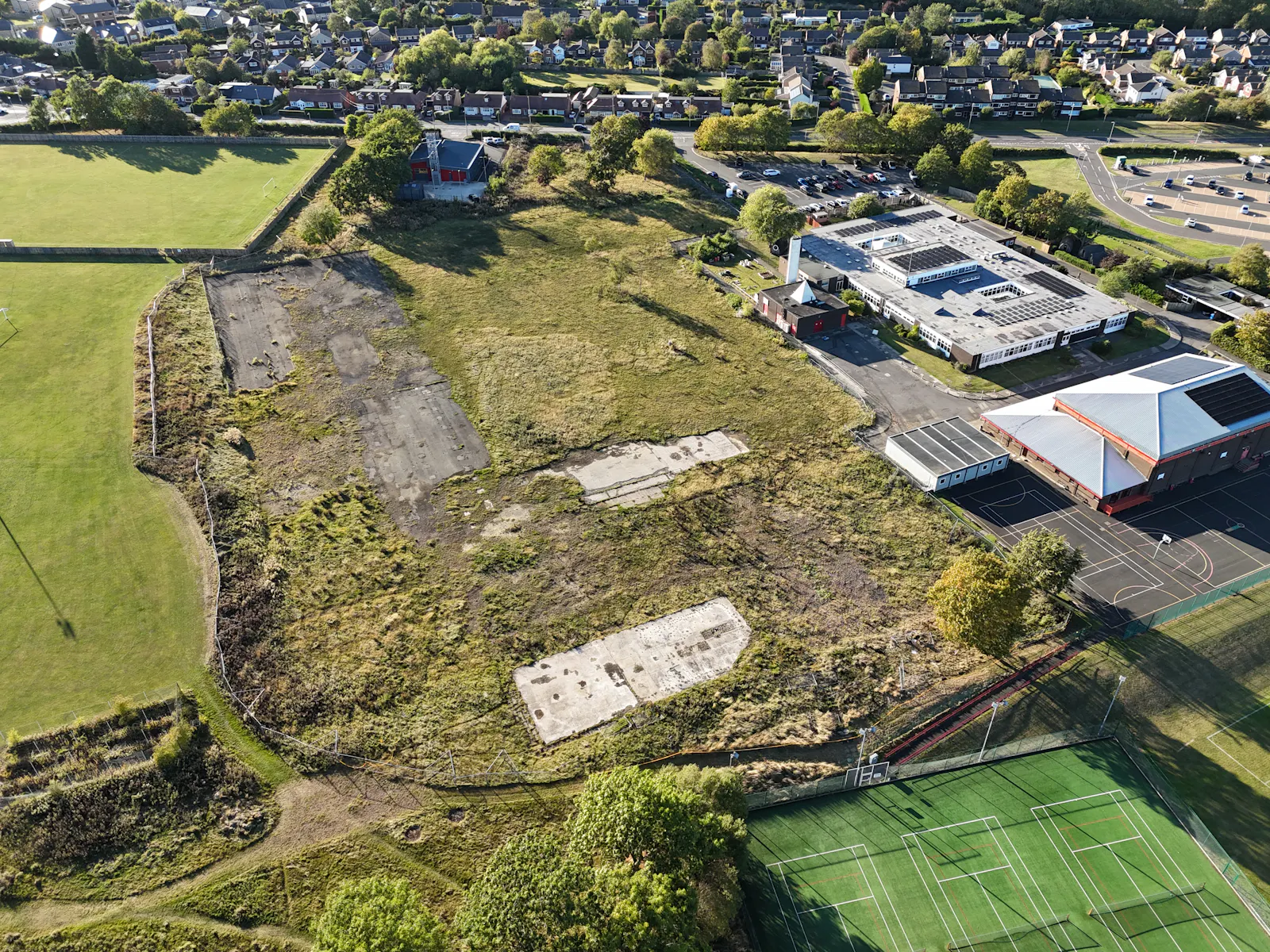
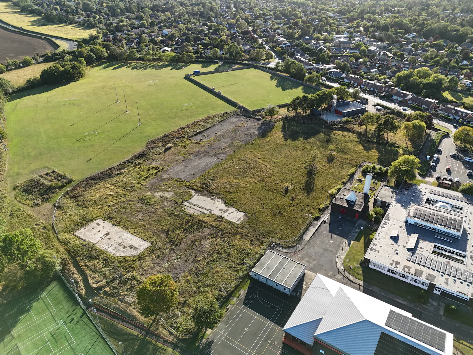
It comprises part of the former Ponteland High School, which was demolished in 2020/21. It has been cleared and is currently covered with a mixture of grass and shrubs.
The former school buildings and accommodation, which covered the site and have been demolished. Previously they incorporated a mixture of one and two-storey buildings and tarmacadamed hard standing/playgrounds. A Site Investigation Report is contained within the data room.
Ponteland Community Primary school is positioned immediately north of the site, with Ponteland Community Fire Station to the west, playing fields to the south and agricultural land to the east.
Specifications
Outstanding development land opportunity in highly sought-after location.
▪ Site area of approximately 5-acres (2-Ha).
▪ Positive Pre-Application Enquiry response received supporting the principle of a range of uses, including residential.
▪ Informal sealed tenders sought by 12noon Wednesday 9th September 2026.
Viewings
Viewing days proposed – please see Viewing Days information within the Data Room. Parties should contact Avison Young to arrange an inspection. No attempt should be made to gain access to the property without prior arrangement and agreement.
Connectivity
Road – The site has road frontage onto Callerton Lane, to the west. Callerton Lane connects to Darras Hall and Rotary Way, to the south, which in turn connects to the A696 which provides direct access to Newcastle International Airport and Newcastle City Centre, to the southeast.
Rail – Newcastle Central Railway Station is located approximately 8.5-miles south-east of Ponteland. The Airport Metro Station is approximately 1.5-miles east.
Air – Newcastle International Airport is approximately 1.5-miles to the east of Ponteland. It provides both scheduled and chartered flights to a range of national and internal destinations.
Tenure
Tenure
The site is registered under the title number: ND109348. It is to be sold freehold with vacant possession and subject to all third-party rights, easements and statutory designations currently passing. Prospective purchasers must satisfy themselves in this regard.
The Site is registered at HM Land Registry under title ref: ND109348. The land hatched blue in the site plan is in the process of being transferred into the ownership of the Vendor.
Planning
The Local Planning Authority is Northumberland County Council. The Council have prepared a Development Brief which is available through the Data Room.
The site is located within the Green Belt. However, given that it consists of Previously Developed Land (PDL), development of the site would not be considered inappropriate as long as it does not cause substantial harm to the openness of the Green Belt.
The Development Brief confirms that the site is well related to Ponteland, providing access to services and making residential reuse more justifiable on planning balance. A minimum of 25% of any dwellings built on the site are to be of affordable tenures.
Downloads
Gallery