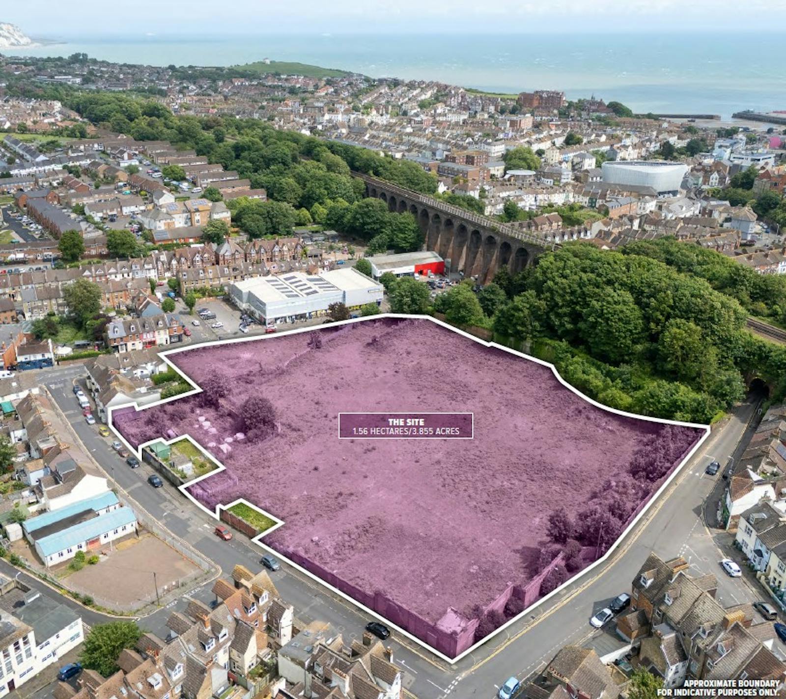
Housing led development opportunity
Summary
- Freehold
- 1.56 hectares / 3.855 acres
- Strategically located
- Potential to deliver a new housing-led development subject to planning
- Outline planning application submitted for up to 135 units
- Brownfield land release fund grant available for site remediation
Location
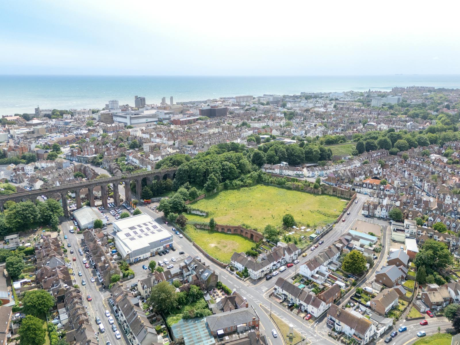
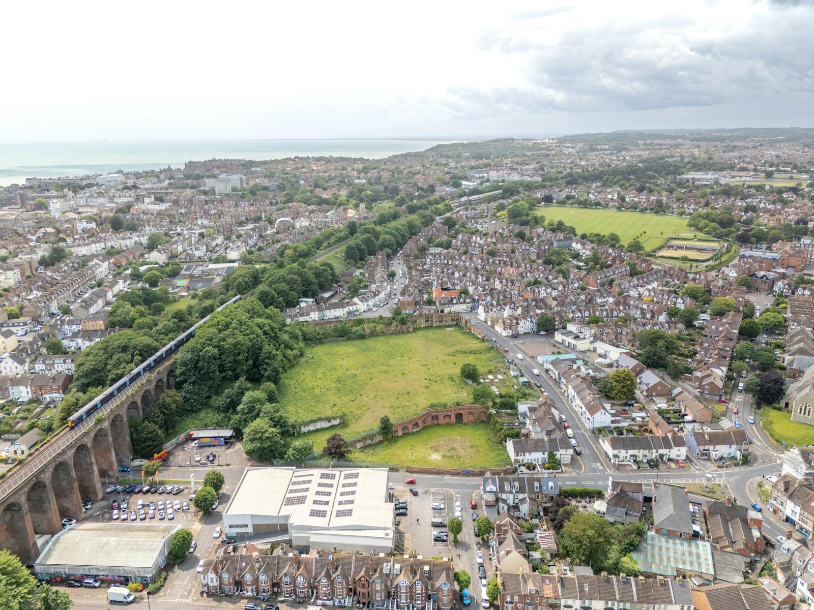
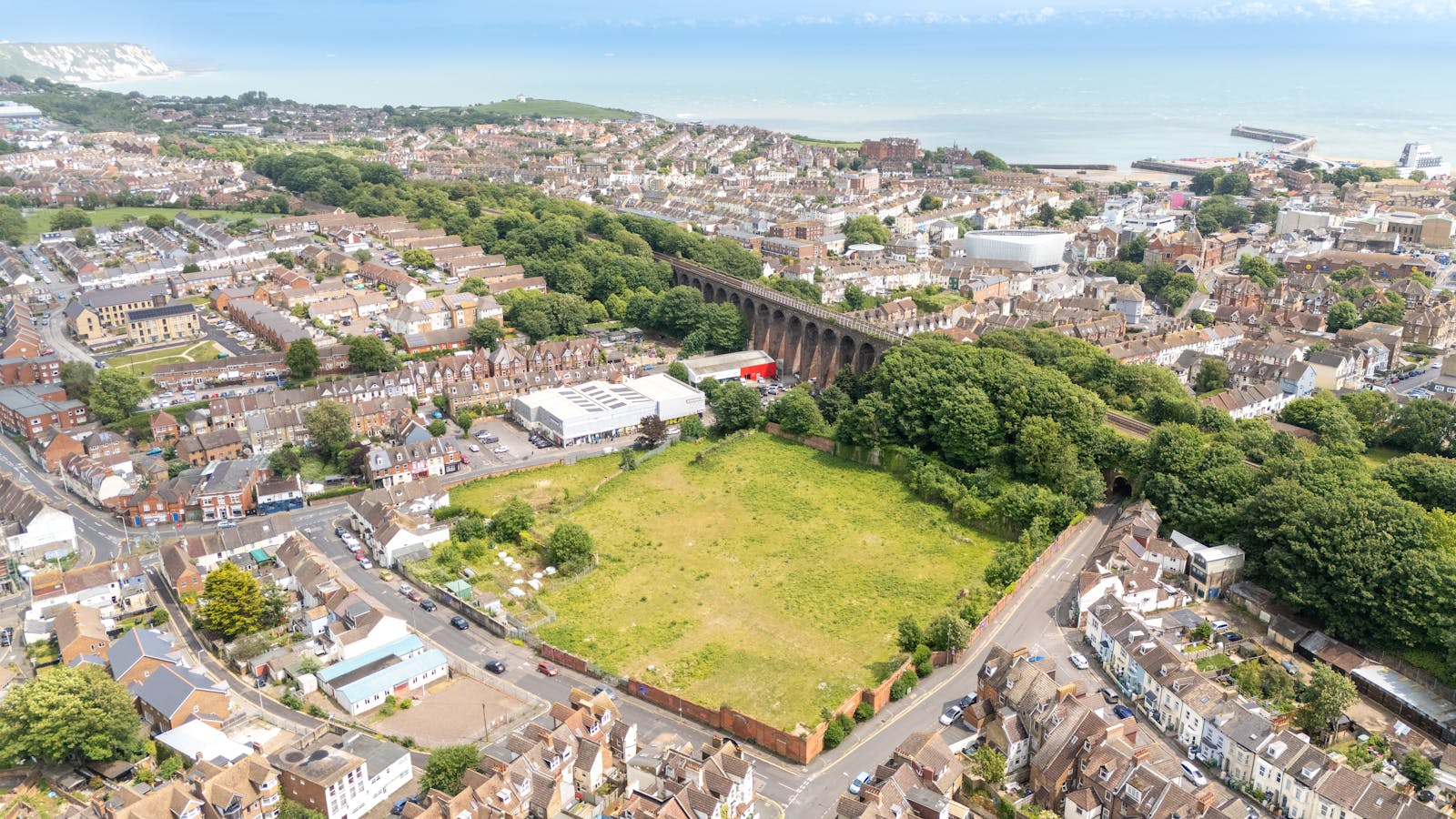
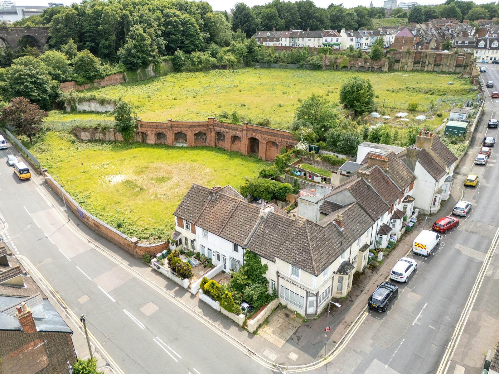
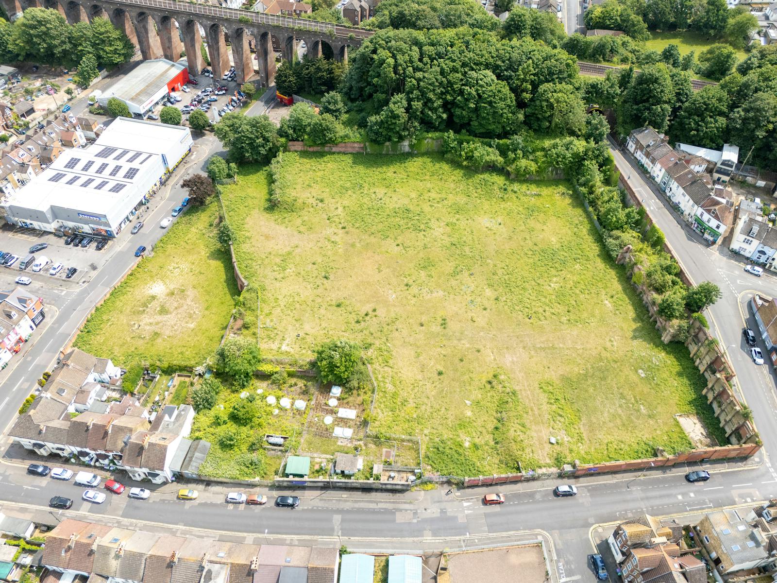
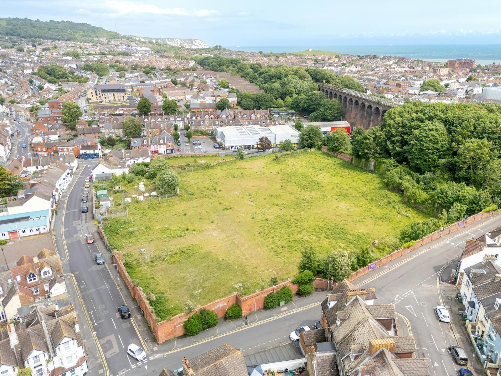
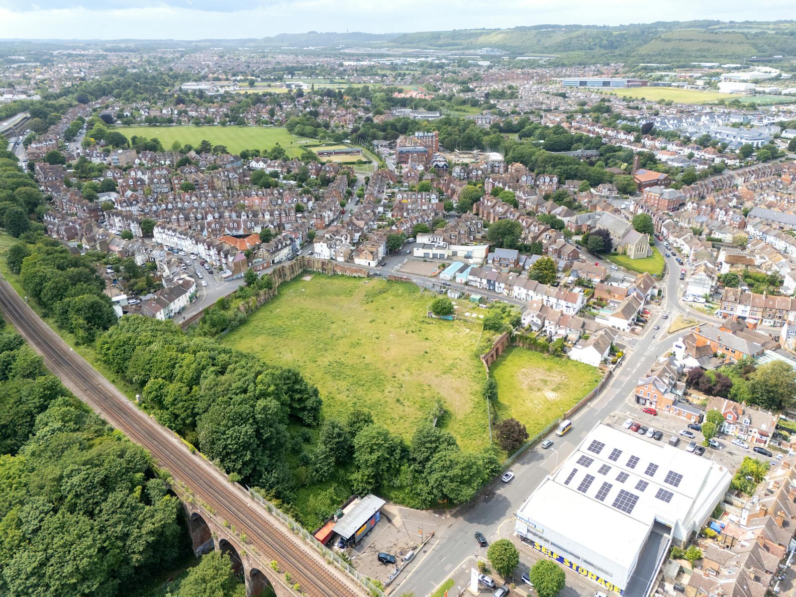
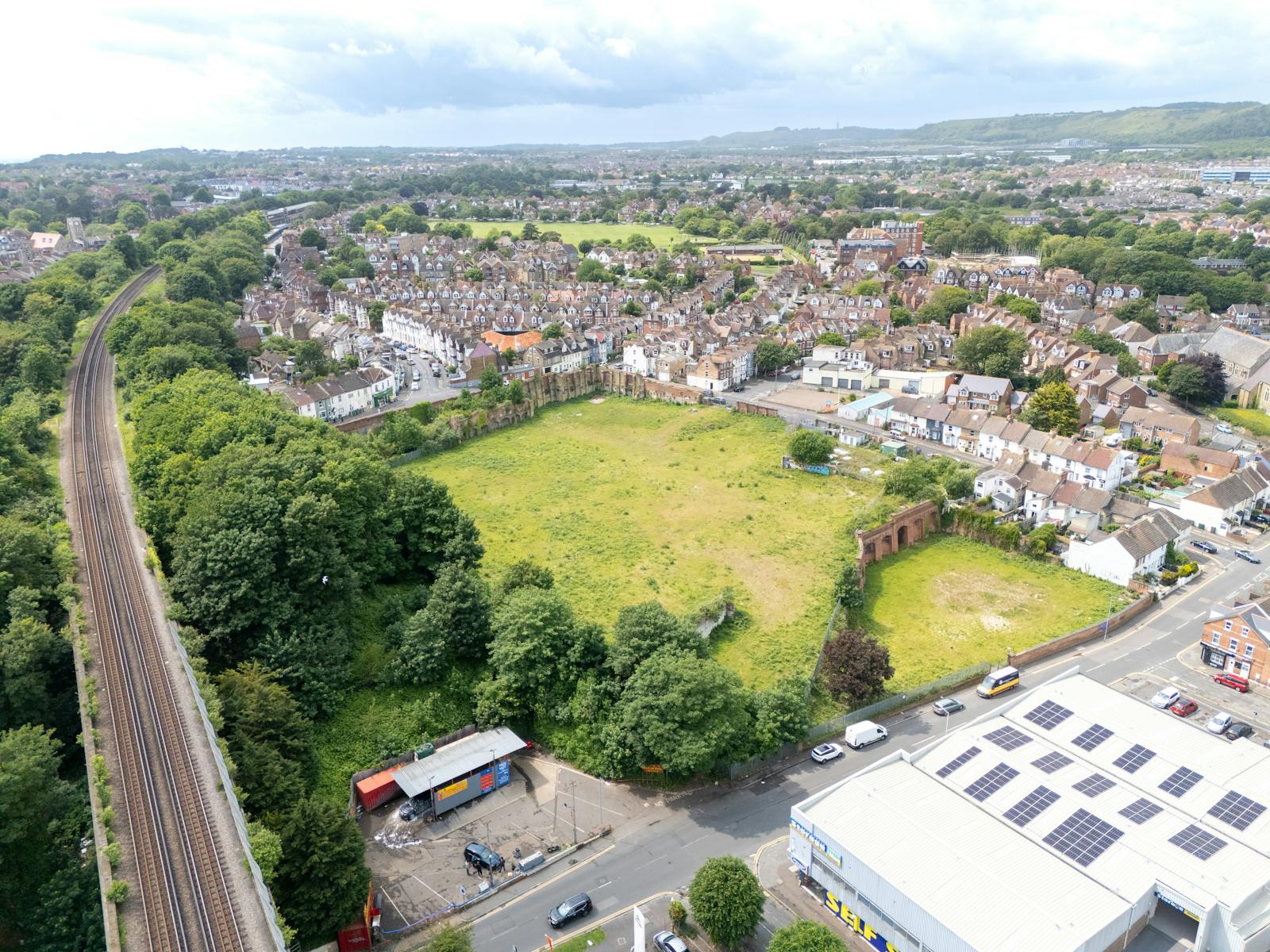
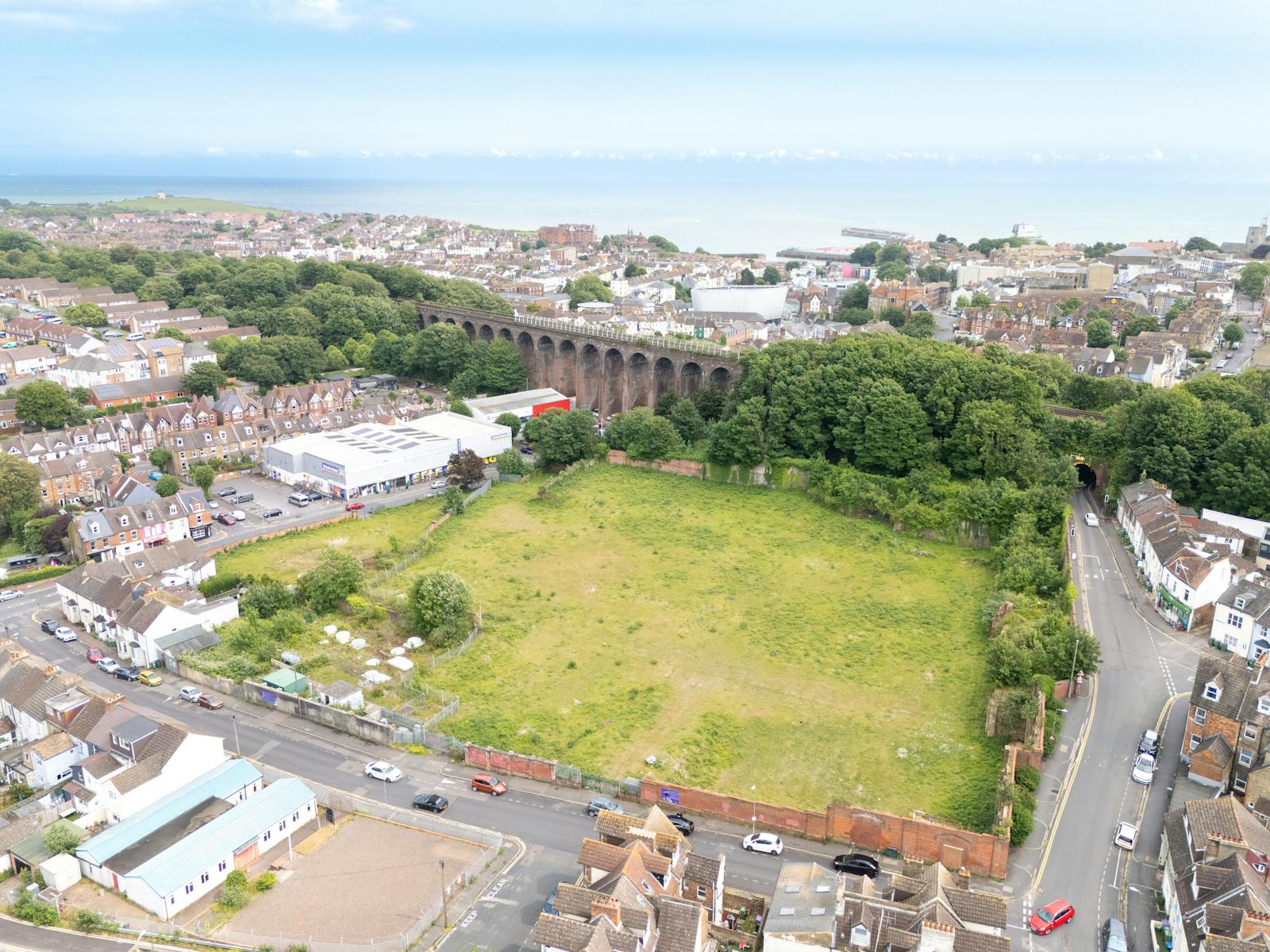
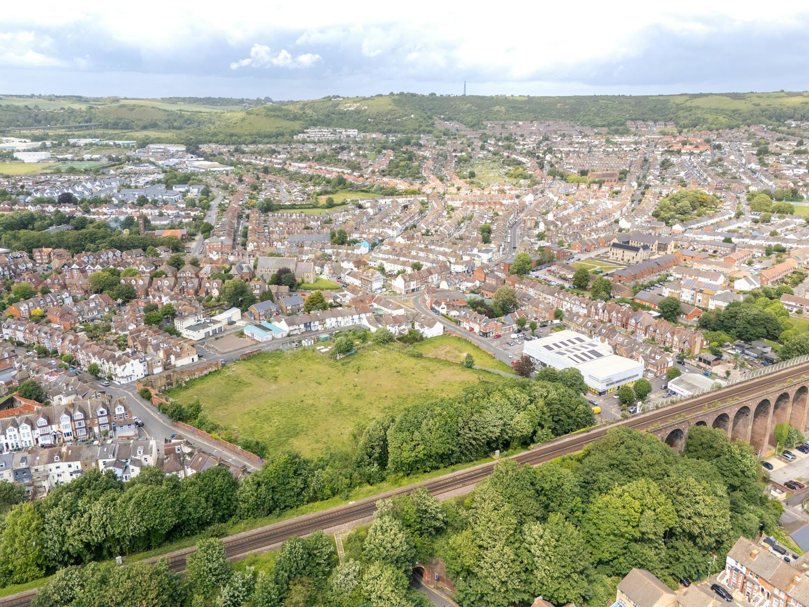
The site is strategically located within walking distance of the town centre and Folkestone Central station, and approximately 0.5 miles north-west of Folkestone Harbour.
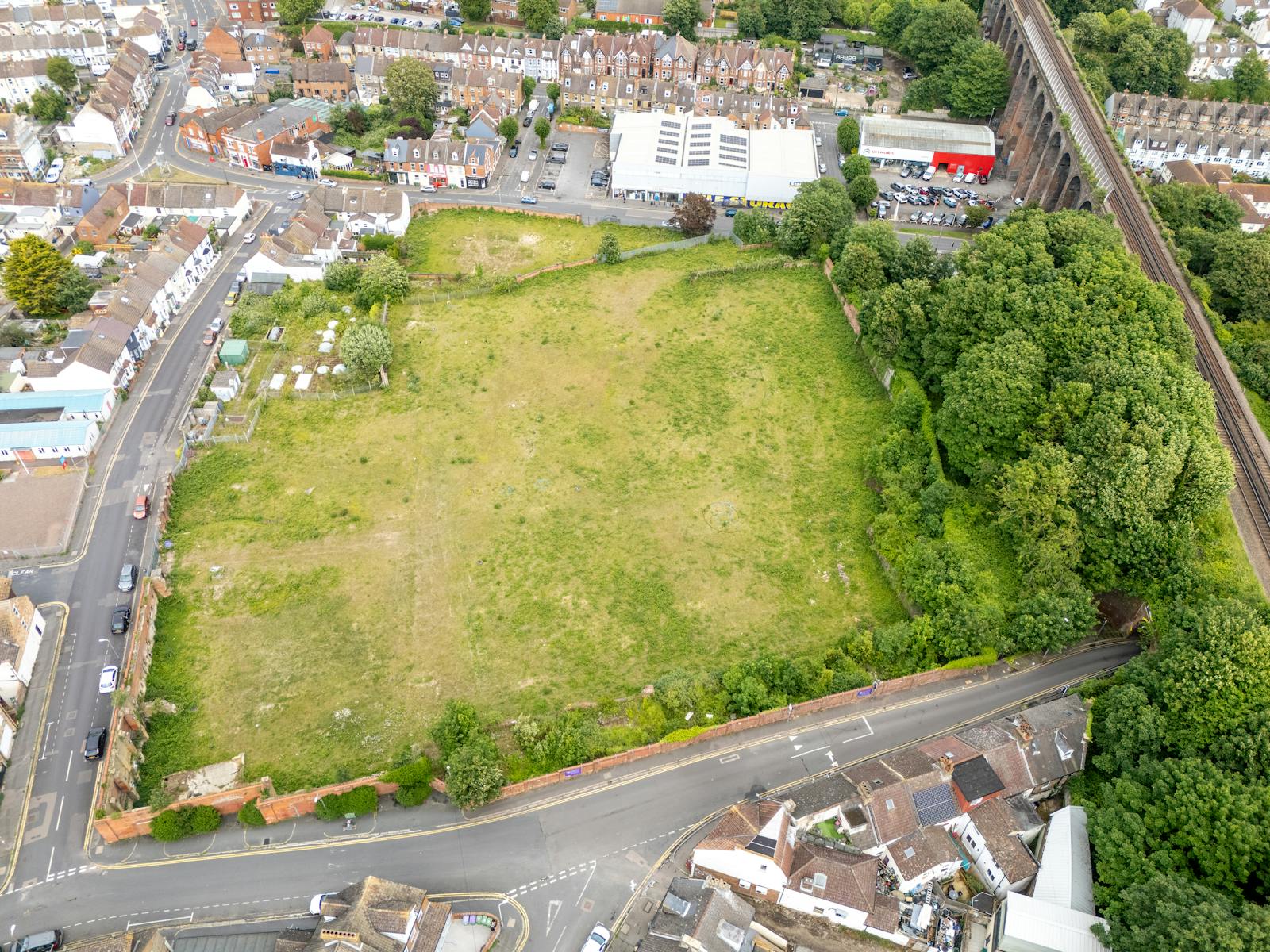
The site is bounded by Ship Street, Foord Road, and Bournemouth Road to the north, east, and west respectively with the railway line situated to the south of the site.
The surrounding area is predominantly residential in character, interspersed with small-scale commercial and community uses. Access to the site is currently achieved via Ship Street, with secondary access available from the eastern boundary via Foord Road.
The site benefits from its proximity to Folkestone Central railway station, located approximately 0.6 miles to the north-west, and is within easy walking distance of the Creative Quarter and the town’s primary shopping streets.
Get directions from Google Maps
Mainline Stations
-
Folkestone Central6 mins
-
Folkestone West19 mins
-
Sandling93 mins
-
Westenhanger117 mins
Underground Station
-
Chafford Hundred914 mins
-
Knockholt941 mins
-
Ockendon941 mins
-
Purfleet946 mins
Further Information
EPC Rating This property has been set as EPC exempt.
Reason: No building present
Description
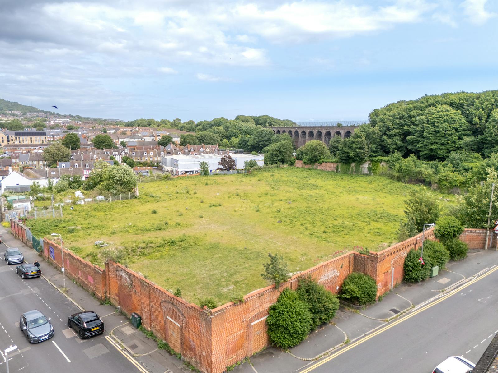
The site is a 1.56-hectacres (3.855-acre) brownfield parcel formerly occupied by a gasworks facility, which ceased operations in 1956.
The gasworks structures were demolished between 1960 and 1964, with the remaining gasholders removed in 2001. It is our understanding that a large-scale remediation of the site took place between 2009-11 and that Brownfield Land Release Fund grant is available for further remediation and to enable construction on-site.
The site is largely rectangular and features a significant topographical variation, with levels falling approximately 12 meters from west to east. Existing retaining walls create a largely flat plateau across the centre of the site.
Given its size, location, and proximity to transport links and local amenities, the site presents a significant opportunity for residential development within an established community. Following their purchase of the site in 2021, The District Council Of Folkestone & Hythe have worked in partnership with Arup and Avison Young to develop a new planning strategy to promote an outline planning application for up to 135 units. Further information is provided in the data room.
Downloads
Gallery