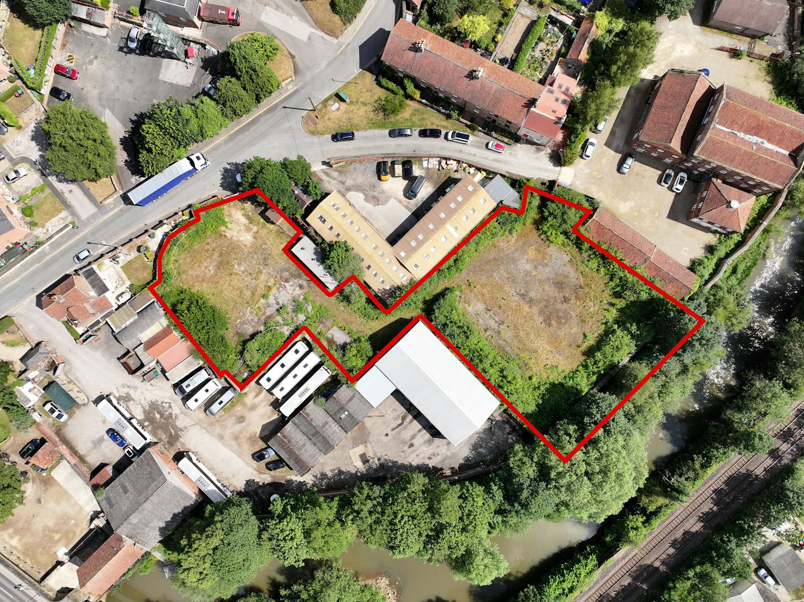
ALL ENQUIRIES WELCOMED - Leasehold site extending to approximately 0.75 acres (0.3 hectares)
Summary
- Development opportunity potentially suitable for a variety of uses, subject to the necessary consents and legal agreements.
- Located in between the picturesque towns of Malton and Norton-on-Derwent.
- Remediated to render the site suitable for a future open storage land use.
- All enquiries and interest welcomed by 25th September 2025.
Location
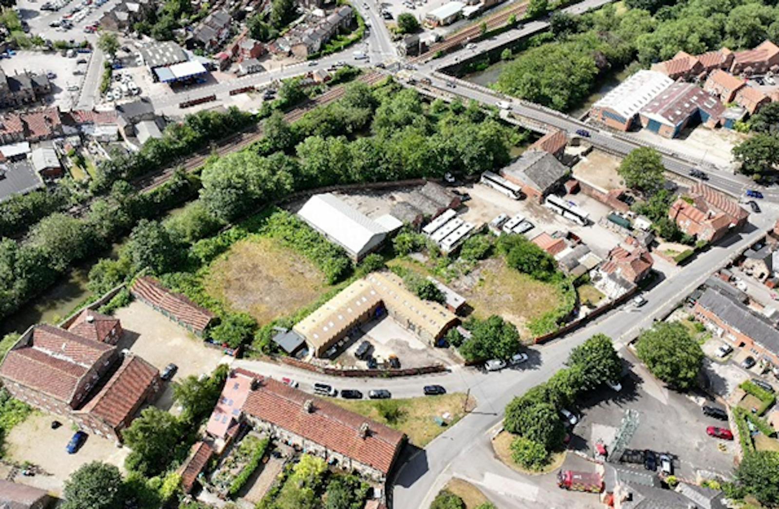
Malton is a market town in North Yorkshire situated adjacent to the A64 providing access to York to the south west and to Scarborough to the northeast. The surrounding buildings are predominantly of industrial use though established residential dwellings are located in the vicinity of the Property.
Malton falls within the former Ryedale District area planning jurisdiction, which is governed by the North Yorkshire Council and the North York Moors National Park. The site is unallocated within the Rydale Local Development Plan. It falls within the Malton Conservation Area.
Sheepfoot Hill joins Castlegate and the B1257 running through the town centre.The A64 running to the north of Malton connects the town to York and Scarborough.
Get directions from Google Maps
Mainline Stations
-
Malton6 mins
-
Seamer324 mins
-
Driffield329 mins
-
York334 mins
Underground Station
-
Chesham3243 mins
-
Broxbourne3246 mins
-
Amersham3285 mins
-
Chalfont and Latimer3295 mins
Further Information
Description
The site extends to c. 0.75 acres (0.3 hectares) which we have measured from an outline Ordnance Survey extract. The Property primarily consists of concrete surfacing and bare ground, with some low level vegetation and trees. The Property is bordered by brick walls to the north and west, and by wooden and wire fencing to the east. The River Derwent is situated to the south.
The Property is held on a Long Leasehold with approximately 1,860 years unexpired.
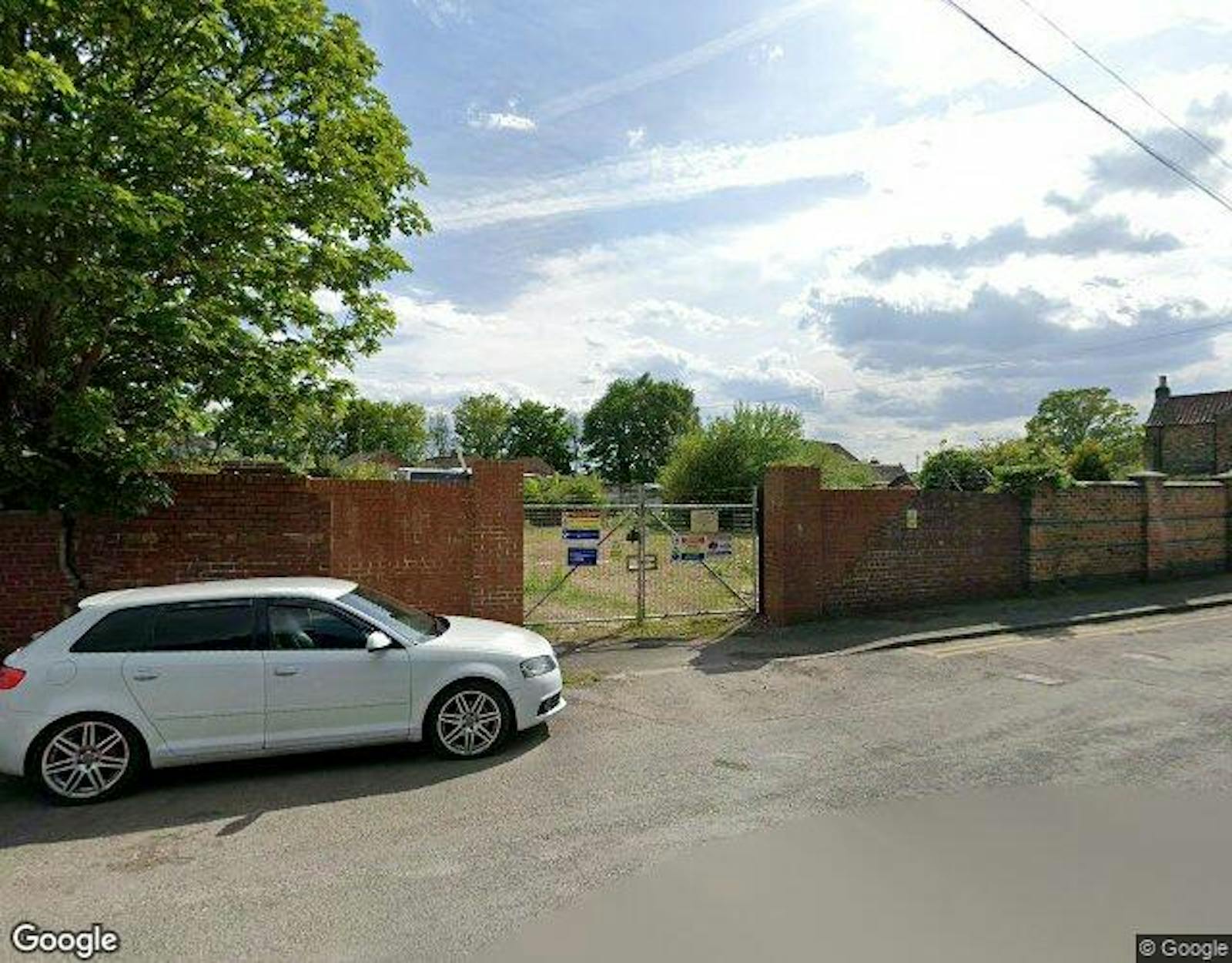
The Property is accessed via the entrance off Sheepfoot Hill, a second gated entrance is available to the rear section close to the adjacent Kingsmill residential development.
Downloads
Gallery