Former Fountains Earth C of E Primary School, 5 Nidd View
Lofthouse, Harrogate, HG3 5SB
1,635 sq ft Enquire NowResidential Self-Build / Residential Development Land (STPP)
A rare opportunity to make this characterful school your home.
Summary
- Rural Self-Build Opportunity (STPP) with Land
- Situated in a Rural Village Location
- Site Area 0.764 Acres/ 0.309 Ha
- Private Treaty Sale
- Offers in the Region of £195,000
Accommodation
The accommodation comprises the following areas:
| Description | Size | sq ft | Availability |
| Ground Floor | 1,635 sq ft | 1,635 | Under Offer |
| Land | 0.76 Acres | 33,279.84 | Under Offer |
| Total | 34,914.84 |
Location
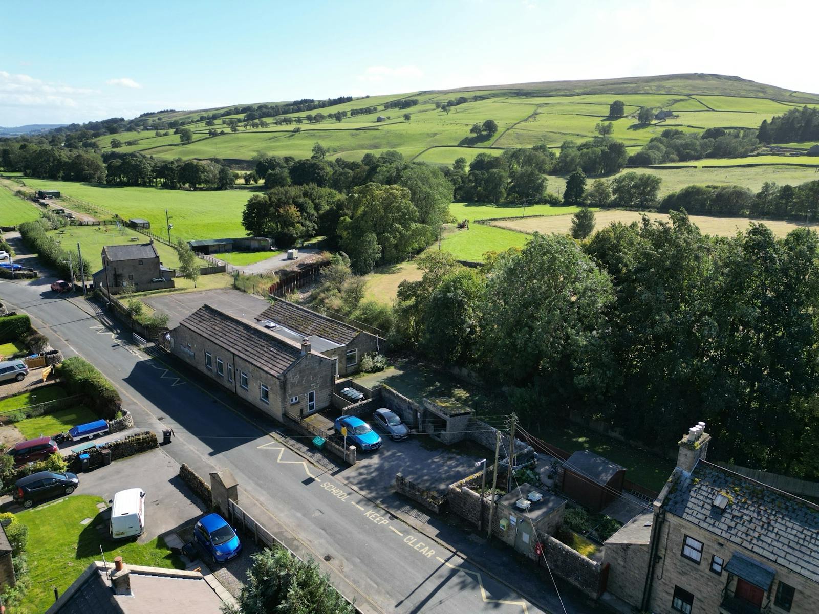
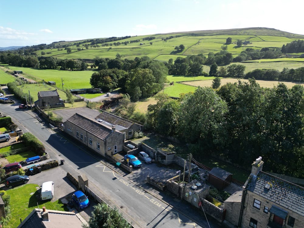
The subject property is situated in the rural village of Lofthouse, within the Harrogate district. Lofthouse is located approximately 21 miles (33.8 km) northwest of Harrogate, 16 miles (25.7 km) west of Ripon, and 32 miles (51.5 km) northwest of Leeds City Centre.
Lofthouse is part of the Pateley Bridge and Nidderdale electoral ward, which recorded a population of 5,548 in the 2021 Census, reflecting a slight decline of 0.52% from the 2011 figure of 5,843. The population density of 22.01 inhabitants per square kilometer underlines the rural character of Lofthouse.
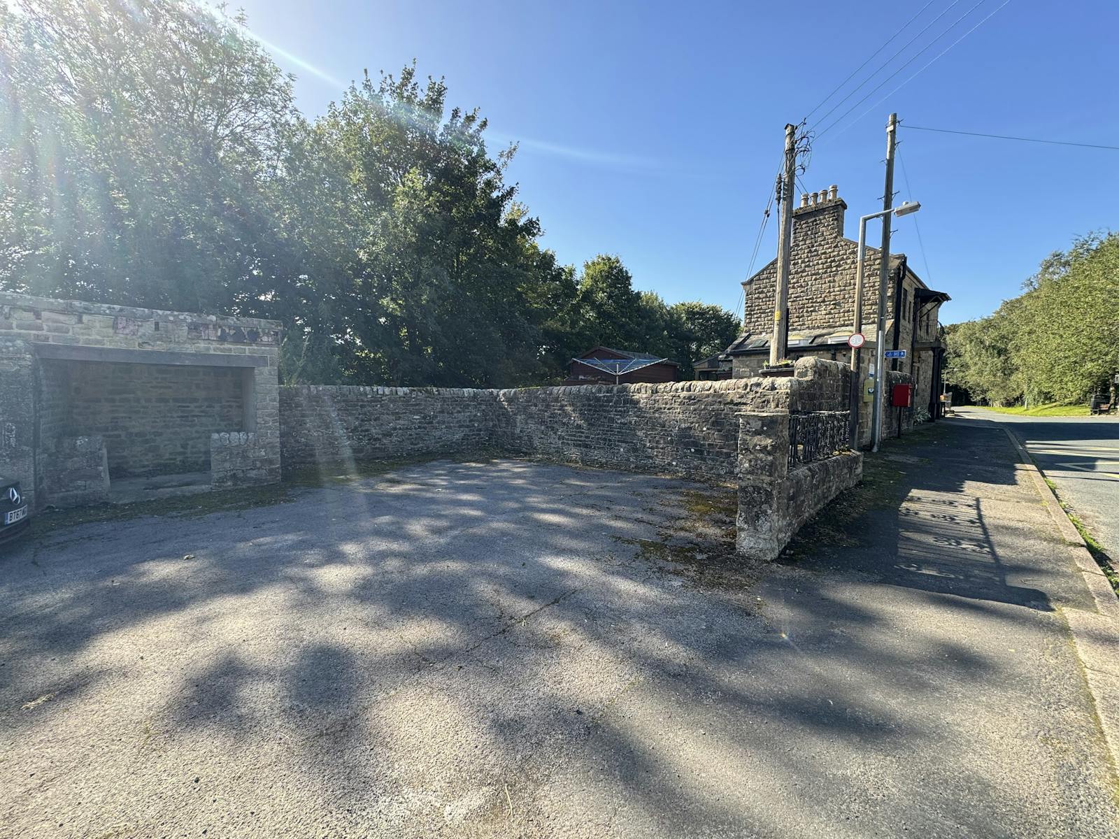
The adjoining land use is predominantly residential, consisting mainly of semi-detached properties. However, the village also features other property types, including larger detached homes and bungalows. In addition to residential properties, Lofthouse includes several local amenities, such as The Crown, a public house and hotel, The Bluebell of Lofthouse, a holiday house, Lofthouse Memorial Hall, and a voluntary fire station. Beyond the built-up area, the surrounding landscape is largely agricultural land and moorland.
Get directions from Google Maps
Mainline Stations
-
Skipton299 mins
-
Ilkley308 mins
-
Ben Rhydding309 mins
-
Gargrave312 mins
Underground Station
-
Chesham3416 mins
-
Amersham3458 mins
-
Chalfont and Latimer3476 mins
-
Chorleywood3504 mins
Further Information
Price Offers in the region of £195,000 VAT Exemption
Rates Payable Upon Enquiry
Service Charge n/a
Estate Charge n/a
Description
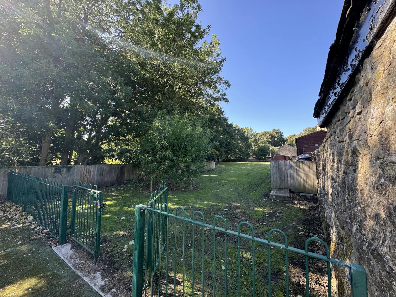
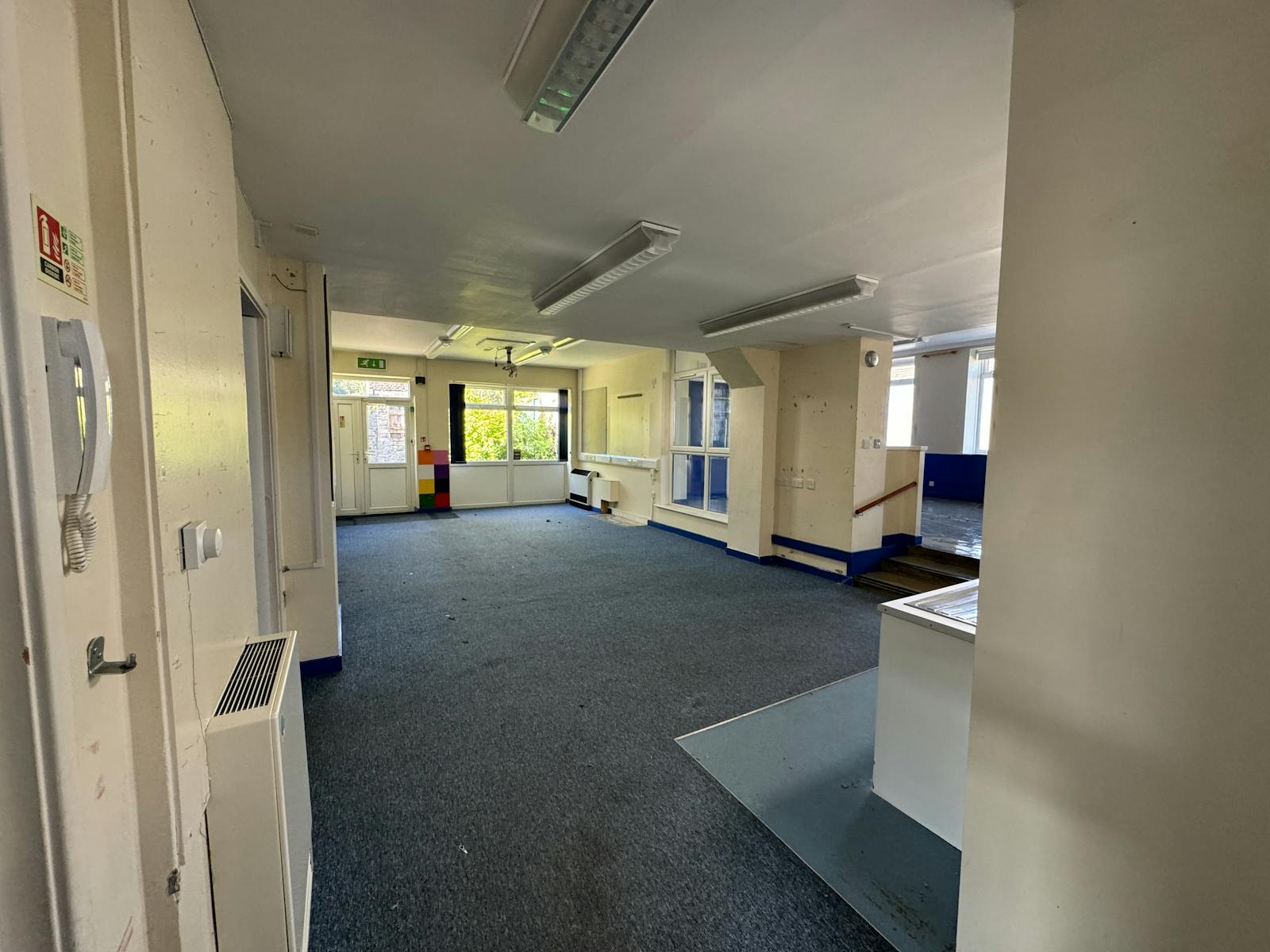
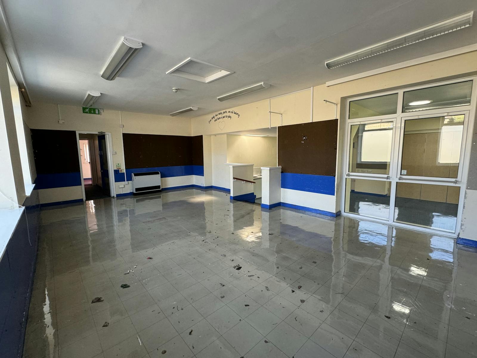
The building is a single-storey structure with weathered stone-built walls, a pitched tiled roof, and double-glazed UPVC windows. The building is set within grounds that include a hard standing courtyard, a grassed playing field, and a parking area. Based on available records, it is estimated that the school was originally constructed in 1895. Internally the building consists of two classrooms, a kitchen, a hall, and male and female restrooms, all contained on one floor.
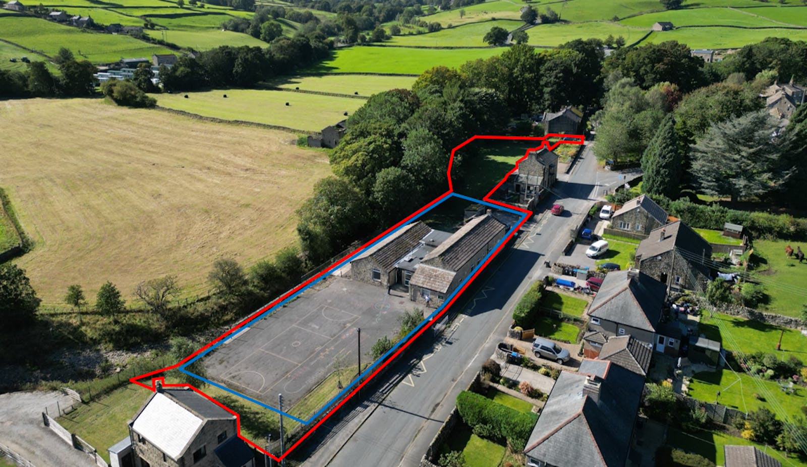
Within the site, the likely permissible development would extend to approximately 0.381 acres (0.158 HA), this area relates to the school buildings, yard and parking area (outlined Blue above).
However, if speculative planning permission could be gained to develop on the playing field which is currently set in a conservation area, the developable area may extend to approximately 0.764 acres (0.309 HA).
Site Area
0.764 acres (0.309 ha)
Floor Areas
152 sqm (1,636 sqft)
EPC
Commissioned
Tenure
We understand that the property is in the freehold ownership of North Yorkshire Council.
Planning
The southern portion of the site falls within Flood Zone 3. As such, any future planning application will require the completion of a Flood Risk Assessment.
During a site inspection we observed that the River Nidd source appears to be protected by large metal sheet piles lining the bank forming the boundary line and there's a substantial height difference between the site level and the bed of the river below. Additionally, the bankside opposite is lower than the bankside of the subject property which likely makes flooding from bank-breaking unlikely.
The majority of the playing field is designated as a Conservation Area under Harrogate’s Local Plan.
Guide Price
Offers in the Region of £195,000.
VAT
VAT is not charged (VAT Exemption).
Legal Costs
The successful purchaser will be responsible for the Council’s surveyor fees incurred in relation to this transaction.
Contact
All viewings are to be arranged by contacting one of the agents below:
Josh.Wraight@alignpropertypartners.co.uk
Daniel.Clinch@alignpropertypartners.co.uk
Gallery